SAR Radar images are a fundmental source to support emergency response activities. They can be of great importance, for example, to detect flooded areas even in case of cloudy weather.
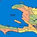
Following the 7.0-magnitude earthquake that hit Haiti on 12 January, international agencies requested satellite data of the area from the International Charter on 'Space and Major Disasters'.